Qhapaq Ñan: The Inca Road System
To facilitate communication throughout their expansive empire, the Inca built over 40,000 kilometers of roads and bridges winding throughout the Andes. This highway system, the Qhapaq Ñan, was primarily not for use by common citizens, and citizens might need to secure official permission and/or pay tolls to use it; rather, it was used for trade and to transport armies and tribute from Inca vassals and to carry messages by means of runners, who would relay goods and information, which was either memorized by the runners or preserved in quipu.
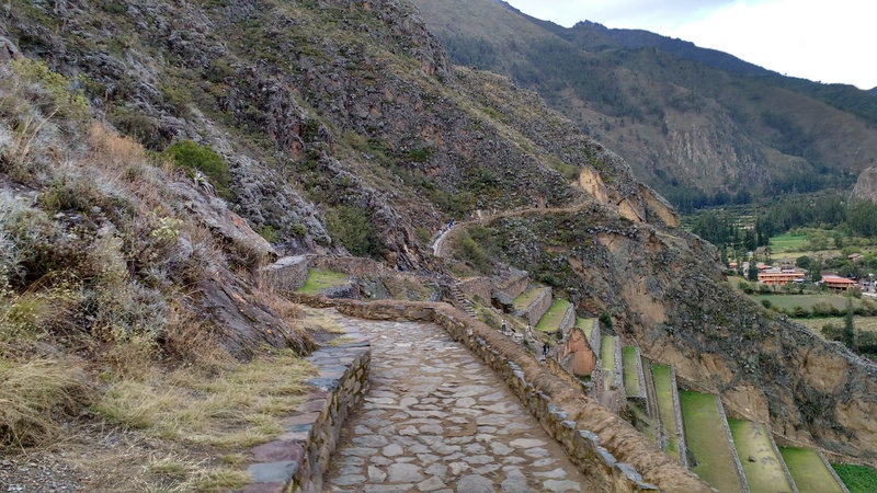
Due to the varying environmental conditions in the Andes, the Inca road network was built from a variety of materials according to what was available in the local area, including wood, stone, and reeds. In places where the terrain became difficult, the road bed was often raised, or the engineers build broad staircases that would admit the passage of llama caravans, or they might build remarkable bridges of grass or stone across streams and chasms.
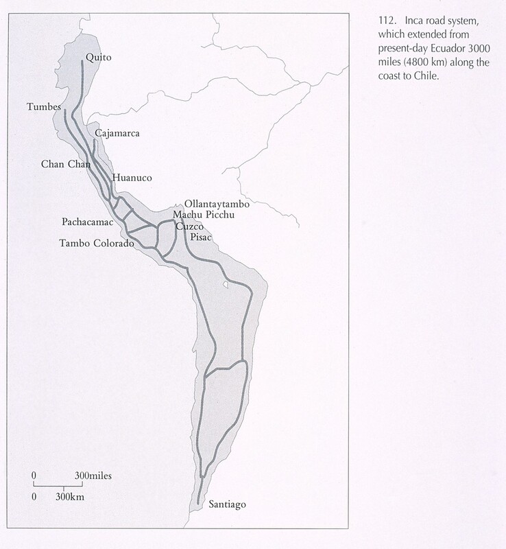
The road system can be seen as organized in two ways-- one, most obvious to the outsider, is as two main highways that travelled north and south along the Andes mountains-- one near the coast, and one at the height of the mountains-- and several subsidiary branches or spurs to connect these two to each other and to other administrative centers. The other, which was how the Inca themselves saw it, was four main roads radiating out from the capital of Cusco, northeast, northwest, southwest, and southeast, which defined the four administrative quadrants of the Inca Empire. In fact, the empire itself was known to its inhabitants not by the name we know it by, but as “Tawantinsuyu” or “the four parts intimately bound together.”
This photo was taken at the Inca ruins of Ollantaytambo, Peru, in 2018. Ollantaytambo lies between Machu Picchu and the Inca capital at Cusco, which lay on the eastern of the two main north-south Inca highways. The road to Ollantaytambo would likely have been a spur road in the Antisuyu quadrant.


